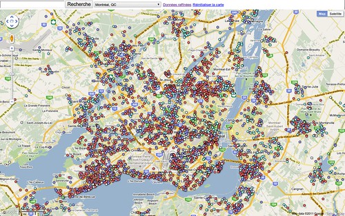
Political financing map in Canada for Cyberpresse
After a few sleepless nights, the political financing map (carte des contributions aux partis politiques) is finally out.
The great thing about doing this project is that we started with what is supposed to be public data and made it actually public. We downloaded it, refined it and mapped it. Although I didn't get around to posting the geocoding results, essentially all the raw data of about 500,000+ entries is made available to the public through Google Fusion Tables. I even used the data I extracted to create my own non-Cyberpresse visualisation (en français).
I think the amount of data displayed will be overwhelming to anyone. Users of the map will be interested to see around places where they live and places that they know, so I think it will be a great platform for crowdsourcing too. I hope you enjoy the map!

Leave a comment